Description
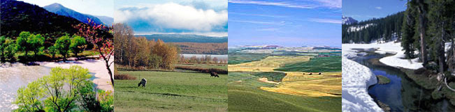
The reference area is situated in the Rhön-mountains
at the border triangle of the three German federal states Thuringia
(former German Democratic Republic), Bavaria and Hessen (Federal Republic
of Germany). The kernel area of the study is Biosphere Reserve Rhön.
The Rhön mountains have elevations between 200
and 950 meters above sea level. Their basement consists of Triassic
sediments (sandstone and shell limestone) which were impacted by
volcanic activities resulting in basalt covering of the higher areas.
The Rhön mountains have not been influenced by glaciers during
the ice ages. As main soils there are different types of cambisols,
partly podsolic in the sandstone areas, rendzina soils in the limestone
area and gleysoils in valleys or peatsoils in the bogs.
With an average temperature of 7°C and an average precipitation
of 640-850 mm the area can be classified as a cold temperate climate.
The structure of landuse can be described as follows:
77 000 ha forest (41 % of the total area), 55 000 ha meadows and
pastures (30 % of the total area), 41 000 ha arable land (22 % of
the total area) and 14 000 ha other uses - including settlement
(7 % of the total area). The main ecosystems, which are found in
the reference area therefore are forests, grassland communities
and arable land. There are also some rare ecosystems like peat bogs
and block areas (basalt).
The potential natural vegetation of the area is deciduous forest
with different beech forest communities except for moist areas in
the valleys where alders would be the prevailing species and peat
bogs and rocky slopes both being naturally woodless. Because many
areas in the Rhön mountains are only extensively used, 40 %
of the forest area consists of semi natural deciduous forest (beech)
whereas the rest is made up of coniferes introduced in the area
for forestal use. Any grassland is of anthropogenic origin however
large parts of it have only been used extensively. Depending on
the underlying rock (either basalt or limestone) and their use as
either meadow or pasture different grassland communties have been
established during the last centuries that used to be typical in
many mountainous areas of middle Europe. Grassland is visually dominating
the area.
The Rhön area is a low-mountain landscape with a mix of landuses
and ecosystems as it used to be typical for similar areas in middle
Europe. The landscape was created by a type of landuse that followed
former generations' technical possibilities and economic needs.
So not the natural but the man-made ecosystems depending on a certain
type of agricultural landuse can be considered typical for such
areas. This type of landuse is now endangered by change in use intensity
(either more intensive or fallow) caused by agricultural politics
focussing on production amounts. The designation as a UNESCO biosphere
reserve in 1991 honors the efforts to establish a sustainable use
in the area. So the area is a part of the world wide system of man-made
biogeographical provinces, which should act as example for sustainable
development.
The main economic activities are light industry, construction, tourism,
agriculture and forestry.
The reference area is suitable for the "Iron Curtain project"
because of its more than ten years history in regional planning
after the reunification of the two German states in 1990. It is
a typical example for the whole former border area in Germany between
the Baltic Sea and the German/Czech border. Problems like large
scale farming, the sealing from industry or settlement building,
waste water deposits and tourism are related to the regional planning
and rural development in the reference area.
|